วันจันทร์ที่ 28 กันยายน พ.ศ. 2552

9 sun miracle of nature ... The most beautiful. When bath with daylight.

0 ความคิดเห็น
7.Magic rainbow. The waterfall Los Susan Tak.


The best time period of approximately 10:00 am
Best season: late rainy season around October to November.
Point of view the best: the top floor next waterfall.


Los Sue waterfall was named most beautiful waterfall in South East Asia, Qiao. A blighted stash hidden wonders of the rainbow. See more water every morning during summer.


This waterfall is in the area of Lookout Umphang district. Multi-storey fall from a cliff high in descending order down through the limestone knoll and green patch of trees. Power Line wonders of this waterfall. If someone climb up to explore the waterfall area on the top floor during the morning will be found to break through the power of light through water droplets spread too much. Into line with beautiful rainbow waterfalls, leaning over the growing astonishingly.


8.Sunrise over the sea fog. Beautiful Dream at Doi Mae international Eming Tak.


Best time: the period around 06.00 pm
Best season: late winter around the rainy season from November to January.
Point of view the best: Simon compressed air.


Doi Mae international Eming Tak many that dream is beautiful sea fog. Rainy season from late winter day is the best time. The longer you can not miss.


And not to be worth far as other points of view sea fog. Sea fog is a beautiful dream. This confirms that not disappointed. If you were to meet on time every morning before daybreak season waiting to see sunrise sea fog has 180 degree views prior to visit Karen village of 200 years plus to know why people in the central mountains deep stash never migration. long as 200 years.


9.See State R. at 360 Sea Mist Ghost kerosene Doi Chiang Rai.

Best time 05.30 - 06.30 pm
Season best. November to December.
Point of view the best. Point of view and the area below the mountain ridge hill top.


Where any sea fog. They found only 180-degree angle toward the eastern mountain spirits kerosene. A good unique beautiful sea fog. But see around 360 S State.


Doi kerosene Ghost watch the sea mist new sources. Most beautiful and most fantastic of Chiang Rai. Hidden beauty in the mountain belt Valentin V. masaruy take district of Chiang Rai travel time approximately 3 hours by car. Most beautiful view in the east is Panarama. See beautiful mountain complex. And also view other available near the mountain at around this. The flight is a source of tea-growing mountain Valentin V.. Chang and Doi, a source of coffee in the name of Thailand. Once here can not see the queen tiger [Sakura Thailand] home also.


วันพฤหัสบดีที่ 27 มีนาคม พ.ศ. 2551

Surat Thani

0 ความคิดเห็น
The largest province of the South located 685 kilometers from Bangkok is Surat Thani the province with a name that literally means "City of the Good People". A former capital of the Srivijaya Empire, the province covers an area of approximately 12,891 square kilometers. Surat Thani Province borders the Gulf of Thailand to the north and east, Chumphon Province to the north, Nakhon Si Thammarat and Krabi Provinces to the south, Phang-Nga and Ranong Provinces to the west and Nakhon Si Thammarat Province to the east.

High plateaus and forested mountains are located to the west of the province, while there are low basins in the center and along the eastern coast. This topography has created 14 river basins including Tapee, Pum Duang, Tha Thong, Tha Krajai, Chaiya, Tha Chang which are the most important basins. All rivers in Surat Thani flow east of the province to the Gulf of Thailand.


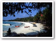
The numerous islands along the coast makes Surat Thani (often known as Surat in short) a perfect hideaway for vacationers from around the world. The ideal destination for many is the Penang-sized Ko Samui, Thailand's third largest island, and its neighbour Ko Pha-ngan a celebrated island that hosts the biggest beach full moon party. North of Ko Pha-ngan is Ko Tao, renowned for its excellent coral reefs. To top it all is the dazzling 250-square-kilometer Ang Thong Marine National Park, where a stunning archipelago awaits to greet visitors with their charming palm-fringed beaches, crystal clear water and colorful coral reefs. The best time to enjoy one of these islands to the fullest is from April to November.


History of Surat Thani

Surat Thani is a city with a long history. Archeologists believe that it was once a community of prehistoric tribes of indigenous people including the Saemang and original Malays who built their communities on the Tapee River Basin and Ao Ban Don. Later on, the Indians migrated into the area and gradually spread out their culture, as evidenced in the discovery of ruins of ancient communities in Tha Chana and Chaiya Sub-districts.


In the 13th century, the city became a part of and, as some historians might claim, a center of the glorious Srivijaya Empire the kingdom that dominated the whole Malay Peninsula and much of Java. It was during this period that Mahayana Buddhist reached its height of influence. The empires grandeur can still be admired in many areas of Chaiya District.


When the empire hit the bottom, it was divided into 3 main cities namely Chaiya, Tha Thong and Khiri Rat. They were all under the jurisdiction of Nakhon Si Thammarat until King Rama IV decided to move Tha Thong City to Ban Don and required that it report directly to Bangkoks administration. The name Ban Don was, at the time, changed to Kanchanadit. It was with the establishment of the Monthon, a former administrative unit, that all three cities were merged into one under the name Chaiya. In 1915, King Rama VI changed the name Chaiya to Surat Thani.


The seal of Surat Thani says a lot about its history. Featuring the pagoda of Phra Boromathat Chaiya, the seal is proof of the influence of Mahayana Buddhist on Surat Thani. Phra Boromathat Chaiya is the most revered and important historical place in the province. It is believed that the pagoda contains Buddha relics.


Today, Surat Thani is an important commercial and shipping hub for rubber and coconut trading.

Rayong

0 ความคิดเห็น
Located approximately 220 kilometers from Bangkok is another delightful resort on Thailand’s eastern coast – Rayong province. A late bloomer, the province is well known for its pristine beaches stretching along a 100-kilometer coastline and scenic waterfalls amidst exotic surroundings. Aside from this, Rayong is blessed with an abundance of seafood products such as shrimp paste, fish sauce and dried seafood, and tropical fruits of which rambutan, mangosteen and durian are the most famous.


Covering a total area of 3,552 square kilometers, Rayong borders Chonburi Province on the north and the west, the Gulf of Thailand on the south, and Chantaburi Province on the east. Most of the land is marked by a series of mountains interspersed by flat plains and large tracts of forest and fruit plantations. Administratively, the province is divided into Mueang Rayong, Klaeng, Ban Khai, Bang Chang, Pluak Daeng and Wang Chan districts and Khao Chamao and Nikhom Phatthana Sub-districts.
Boasting indispensable sea-life resources, Rayong is one of the country’s major agricultural and industrial provinces. On the other hand, the province has maintained its traditions and customs in the daily lifestyle of the locals. The best months to visit Rayong are from November to February.

The Part

During the late Ayutthaya period, when the former capital was being razed to the ground by the invading Burmese, Phaya Tak led a troop of patriots, broke through the cordon of besieging troops and marched to Rayong in order to build up his navy before proceeding on to Chanthaburi. Because of his courage and bravery, the soldiers and local population anointed him as "King" in Rayong. Once he had built up sufficient troop strength, Phaya Tak

who later became King Taksin of the Kingdom of Thonburi returned to Ayutthaya, routed the Burmese and set up a new capital in Thonburi.

Uttradit

0 ความคิดเห็น
A province in the Lower North, Uttradit has a long history developing through the years since pre-historic time.
The site of the original town, then called Bang Pho Tha It, was located on the right bank of the Nan River. It flourished as a port for goods transportation. As a result, King Rama V elevated its status into a province and re-named it Uttradit, literally the Port of the North.

Uttradit is located 491 kilometres from Bangkok and covers an area of 7,838 square kilometres and is divided into the following districts: Muang, Tron, Laplae, Phichai, Tha Pla, Nam Pat, Fak Tha, Ban Khok, and Thong Saen Khan.

Chanthaburi

0 ความคิดเห็น

Famous for its abundance of tropical fruits and as a centre of gems, the eastern province of Chanthaburi is also blessed with rich, verdant forests with scenic waterfalls. The Chanthaburi River flows through the town which has been the home of ancient communities. Quiet fishing villages and peaceful beaches are not far from town.
Chanthaburi was occupied by the French during the early part of the 20th century. Their influence can be seen in the architecture of many buildings including the largest Catholic cathedral in Thailand, catering to a sizeable Christian population.

About 245 kilometres from Bangkok and covering an area of 6,338 square kilometers, Chanthaburi as administratively divided into the following districts:- Mueang Chanthaburi, Tha Mai, Khlung, Laem Sing, Pong Nam Ron, Makham, Soi Dao, Na Yai Am, Kang Hang Maeo and Khao Khitchakut sub-district.

Kanchanaburi

0 ความคิดเห็น
According to most historians, the ancient town of Kanchanaburi was located near Ban Lat Ya, a small village situated approximately 16 kilometers north of the present town. The site was repeatedly recorded in Thai history as an invasion route which the Burmese used to enter Thai Kingdoms.

Kanchanaburi, which has mostly mountainous terrain, covers an area of approximately 19,473 square kilometers and is the third largest province in Thailand after Chiang Mai

andNakhonRatchasima. Situated approximately 129 kilometres west of Bangkok, Kanchanaburi shares a border with Myanmar to the west, Tak and Uthai Thani Provinces to the north, Suphan Buri and Nakhon Pathom Provinces to the east, and Ratchaburi Province to the south.

In north and west Kanchanaburi, the terrain is comprised mainly of mountains and high plains, with the Thanon Thongchai Range acting as a natural border between Thailand and Myanmar. The range is the source of Kanchanaburi's two most important rivers Maenam Khwae Noi and Maenam Khwae Yai, which form the famous Maenam Mae Klong. As a result, several of Thailand's largest Namtok (waterfalls) and most extensive wildlife sanctuaries are found in this area.


The magnificent landscape and charming beauty of Kanchanaburi have resulted in major tourist attractions including several well-known waterfalls, caves which were once inhabited by Neolithic man, pristine national parks, tranquil rivers, virgin forests, and reservoir. Together, they offer an intriguing experience for first-time or repeat visitors. Whether its fishing, rafting, canoeing, mountain biking, bird-watching, star-gazing, golfing, elephant and jungle trekking, or even living in bamboo rafts, Kanchanaburi takes pride in offering them all.

The city of Kanchanaburi is located at the point where two tributaries, the Khwae Noi and Khwae Yai meet and form the Maenam Mae Klong. This is the location of the notorious Death Railway and the Bridge on the River Khwae one of the worlds famous World War II sites which have been immortalized in print and film.

In economic terms, Kanchanaburi has been doing well on a national scale, with over 10 per cent growth annually. Important industries include sugar, agricultural products and jewelry. Tourism is also a main source of income for the locals as the provinces high tourism potential has made Kanchanaburi number one among the west provinces in having the highest number of visitors each year.
Residents of Kanchanaburi are engaged in agricultural activities. Most of the locals are of Thai ancestry with notable Mon and Karen minorities. Rural dwellers enjoy living simply and respecting nature. Moreover folk music and dances dating back at least 500 years are still performed today.

Featured Video

Followers


Attractions interesting. Since that first impression.. Copyright 2008 All Rights Reserved Revolution Two Church theme by Brian Gardner Converted into Blogger Template by Bloganol dot com